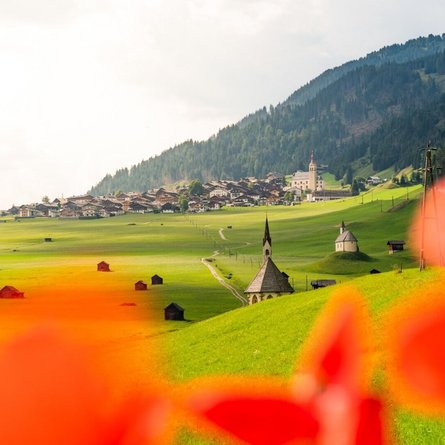
The Lasörling Altitude Trail can be walked in different variants. The easy variant starts with a taxi ride to the Wetterkreuzhütte and ends after 3 stages in Ströden. The classic variant starts in Matrei in Osttirol and leads in 4 - 6 stages along the entire Lasörling Group on the south side of the Virgental valley.
Starting from Matrei i.O. you reach the Zunigalm through a beautiful mountain forest after about 4 hours walking time. A stop at the Zunigalm is always worthwhile, it was already mentioned in the Gault Millau. From here the path leads westward, past the Arnitzalm over the ridge and valley cuts to the Wetterkreuz hut. This base can also be reached by hut cab from Virgen and can therefore be chosen as an alternative start. On the second section of the Lasörling High Trail you reach the Zupalsee Hut via the Heflerhöhe, which is overgrown with dwarf shrub heath. Continue over the Lasörling ridge with a magnificent panoramic view over the valleys shining in dark green. Above, in contrast, the shining peaks and snow surfaces of the Venice massif. You can also take refreshment at the Merschenalm, before arriving at the Lasörling hut after another 2h of walking. The Lasörling hut is the starting point for the ascent to the Lasörling (3,098 m) and several alpine crossings.
In early summer, the alternative route out of the valley to the Berger Alm and then to the Bergersee Hut is recommended. The normal route runs after the Lasörling hut first over the Berger Törl (there can still be snow fields here even in summer) to the Bergersee hut. The access to the Lasnitzental to the snack station Lasnitzen Alm leads over the Muhs-Panoramaweg high above Prägraten a. G. From there you get over the Micheltalscharte, the Rote Lenke to the Bödensee and to the Reichenberger hut. The last section leads over deep green hills to the Daberlenke and through the Dabertal further to the Clara Hut. As a conclusion of this wonderful long-distance trail, you can enjoy the beauty and wildness of the Umbal Falls, where you will find the Islitzer Alm at the end.
With the exception of a few crossings that link up with the high trail, hikes can be made in various directions through the alpine landscape of the Virgentaler Schattseite. Each hut has several accesses and can also be reached from the valley. Despite considerable differences in altitude, the Lasörling Höhenweg is also suitable for families. However, it is advisable to adapt the tour to the children. For mountain-experienced hikers or in the company of mountain guides, many fantastic summit tours are offered along the trails. From easy summits to difficult ascents - if you have an eye for nature and take the time, you will take home many beautiful impressions and experiences.
Note: There is no accomodation possibility at the Zunigalm and Wetterkreuzhütte!


