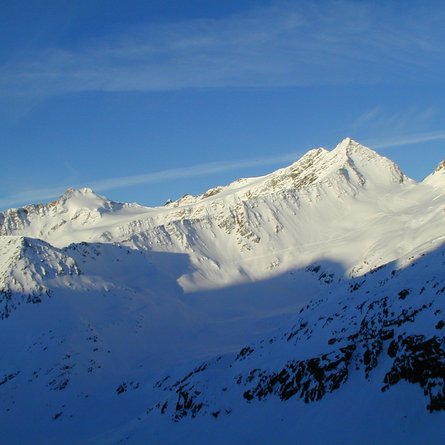
The corniced ice pyramids of the Simonyspitze are among the top-notch tour destinations in the catchment area of the Essener-Rostocker Hütte, and anyone who has ever been out and about on the crevasse-rich Simonykees will have been taken by the austere beauty which these mountains exude. Superb glacier ramps provide the ascent route on both these firn snow slopes. Depending on the snow conditions these are only passable in spring on skis, the chasms und holes are too great when there is not enough snow coverage.
The base for our tour is the Essener-Rostocker Hütte (2208 m) in Maurertal, which we get to from the hamlet of Ströden/Hinterbichl (1400 m) in 2 ½ hours. Please be aware that the ascent to the Alpine lodge has a risk of avalanche. In the base area behind the mountain accommodation we follow the ski track in a westerly direction via a short slope to Simonysee (2361 m), where we can see our tour destination throughout the ascent. Between 2400 m and 2500 m we enter the slim ice tongue of the Simonykeeses. The ski track then proceeds in a northerly direction, climbing continually on the left glacier edge (west) in firn snow beneath the Simonyspitzen (around 3050 m), at the foot of the stunning east face of the Gubachspitze. If the crevasses at the edge area are too large due to the varying flow rates of the ice masses, you have to deviate at 2800 m into the middle of the glacier, to make your way to the upper firn snow area (depends on the conditions). For the ascent of the Westliche Simonyspitze we stay on the left (western) bank area and take the narrow glacier ramp, which goes down from the summit. To the left (west) of the serac break-off proceed higher up in hairpin bends, before at around 3250 m we carefully cross the at times large diagonal crevasse. An enjoyable crossing takes us to the final firn snow crest which takes in a steep slope which is often hard (up to 35°, crampons). (4 hours from the lodge). Descent along the ascent track. Tackle the glacier using ropes!
Additional ski tour tips can be obtained in the ski tour guides by Thomas Mariacher. These are available here: http://www.grafikzloebl.at/verlag/buecher/


