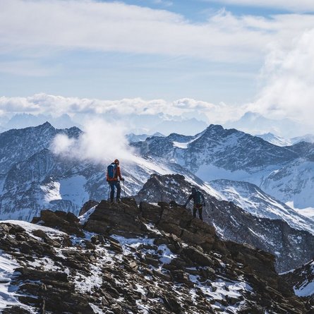
Tackling the Hochstadel in the eastern wings of the Lienz Dolomites is really only recommended when there is plenty of snow in the winter, when the 11 km gravel trail from Hochstadelhaus (1780 m) to Pirkach (630 m) can be tackled wholly on skis, thereby guaranteeing 2000 metres altitude descent. What’s more the lovely white stuff in the top section makes it possible to shorten the relentless road along the summer trail. Otherwise for the hardcore among you there is the option of tackling the snow by bike to enjoy the seclusion which reigns around the Unholdenalm. Starting point is Oberpirkach (630 m). In Oberdrauburg we head for Gailbergsattel, where the signposts right after the railway crossing on the right take us to Unter- and Oberpirkach (5 km). Right at the last farmhouses is where a forest road to Hochstadelhaus begins, which we, depending on the snow conditions, follow along the summer trail or take a short-cut through forest terrain to get to traditional pasture terrain. There is of course the option of avoiding the first hairpin bends on the forest road via the lower section of the summer trail. This starts 300m before Oberpirkach at the bridge at Pirkner Bach and heads steeply up to a goods road. Having reached Almendorf (2 ½ hours from the valley), the view into the Drautal opens up and another climb now heads west to the Garnitzenkar. A few hairpin bends via a south-east facing steep slope (up to 35°, possibly carry skis) leaves this route and climbs into a wind gap (around 2250 m) to the west of the Rudnigkofel. The ski track now swings westwards, continually climbing, in another wind gap, before we zigzag via the wide east ridge to get to the summit. The north face is impressive and is one of the three highest in the East Alps and in terms of difficulty level is considered to be up to level 3. Descent along the ascent track.
Additional ski tour tips can be obtained in the ski tour guides by Thomas Mariacher. These are available here: http://www.grafikzloebl.at/verlag/buecher/


