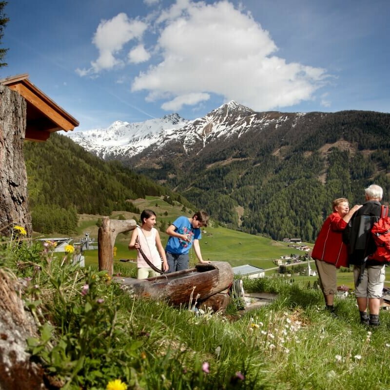
Walter Mair Trail Lienzer Talboden

Discover the beauty, diversity and sights of the Lienz Talboden.

The Lienzer Talboden is framed in the north by the foothills of the Hohe Tauern, in the west by the last ridge of the Villgrater mountains, in the northeast with the Ziethenkamm from the Kreuzeck group and in the south by the rocky peaks of the Lienz Dolomites. Just as different as the mountains are the scenic features that can be experienced along the Lienzer Talboden circular hiking trail. Starting at Schloss Bruck on the western outskirts of Lienz, the 45 km loop first leads along the Hochstein and the foot of the Lienz Dolomites, changes to the sunny side in the area of the Carinthian Gate and then returns to Lienz, mostly running above the valley floor. Numerous natural and cultural highlights await hikers along the route. It is also worth taking a break at the various refreshment stops. Those who find the entire round too strenuous can complete the tour in individual stages.


Walter Mair Trail Lienzer Talboden

starting point:
Talstation Hochsteinbahn
destination point:
Talstation Hochsteinbahn
highest point:
1046 m
total walking time
15:40 h
distance
45 km
🔋
altitude meters uphill
1249 hm
🞽
difficulty
easy

Impressionen

back
Next
Church St. Ulrich, Lavant
Frauenbach Waterfall, Lavant
Sunways, Gaimberg
Sunways, Gaimberg
Castle Bruck, Lienz
Castle Bruck, Lienz

The stages of the Walter Mair Trail Lienzer Talboden

Walter Mair Trail Lienzer Talboden - Stage 1

starting point:
Talstation Hochsteinbahn
destination point:
Talstation Hochsteinbahn
total walking time
5 h
distance
10 km
🔋
altitude meters uphill
375 hm
🞽
difficulty
easy

The nature trail from Castle Bruck to Leisach offers insights into the biodiversity of the local forest. Furthermore, you pass the natural monument "Old Lake", then climb up to Kreithof and finish the first stage on historical sites at Lavanter Kirchbichl.

Walter Mair Trail Lienzer Talboden - Stage 2

starting point:
Talstation Hochsteinbahn
destination point:
Talstation Hochsteinbahn
total walking time
4 h
distance
12 km
🔋
altitude meters uphill
80 hm
🞽
difficulty
easy

The Lavant forest nature trail and the two-stage Frauenbach waterfall are must-sees. Accompanying the river Drau, which changes from grey to green, and the moor-dark Auenlaue, you are in the quietest corner of the Lienz Talboden. Nikolsdorf with Nörsach, or Chrysanthen, is the easternmost municipality in Tirol.

Walter Mair Trail Lienzer Talboden - Stage 3

starting point:
Talstation Hochsteinbahn
destination point:
Talstation Hochsteinbahn
total walking time
4:20 h
distance
14 km
🔋
altitude meters uphill
330 hm
🞽
difficulty
easy

The trail from Chrysanthen near Nikolsdorf, to the Zettersfeldbahn (cable car) station, passes through the four municipal areas of Nikolsdorf, Dölsach, Nußdorf-Debant and Gaimberg. From always a low elevation, you have a view of the large Lienzer Talboden.

Walter Mair Trail Lienzer Talboden - Stage 4

starting point:
Talstation Hochsteinbahn
destination point:
Talstation Hochsteinbahn
total walking time
2:20 h
distance
8 km
🔋
altitude meters uphill
100 hm
🞽
difficulty
easy

Oberlienz and Oberdrumm spread out on the sunny Schleinitz Schuttkegel. The village settlement stretches along the Schleinitzriver stream. An open-air museum with 13 themed stations along the village road introduces visitors to historical objects. The varied hike ends at the river Isel, where you can take the Katzensteig trail to Castle Bruck.

Walter Mair - Book

Trail Lienzer Talboden

The book, with 98 pages, some maps and many interesting descriptions, is available at the Osttirol Information (Mühlgasse 11, Lienz) for € 7 ,- during opening hours.

You may also be interested in

Iselstrände Etappe 2
Iseltrail

Unique adventure route through a magical water wonderland with individually selectable sections!

Talrundweg Kals - Rastplatz Schoberblick
Talrundweg Kals

Your circular hiking trail around the Kalser valley basin.

Newsletter

Subscribe to our newsletter and receive the best tips every month for current offers, mountain tours, events and much more.