Toblacher Pfannhorn

The most important at a glance

distance
9.8 km
altitude meters uphill
🔋
1020 m
altitude meters downhill
🔋
1020 m
walking time uphill
2:30 h
walking time downhill
2 h
total walking time
4:30 h
highest point
🞍
2650 m
difficulty
🞽
average
fitness:

* * * * *

🞙🞙🞙🞙🞙

technique:

* * * * *

🞙🞙🞙🞙🞙

public transport:

Mit dem Bus bis zur Bushaltestelle "Innervillgraten Kalkstein".

parking:

Parkplatz Kalkstein

starting point:
Innervillgraten, Kalkstein
destination point:
Toblacher Pfannhorn
best season:
MAY, JUN, JUL, AUG, SEP

arrival

Parking spot

Car park Kalkstein 1.640m

altitude profile

Pdf file

Gpx file

Interactive map

Current weather conditions

Schnee-01-02-03.png

0°C/32°F °C

Description

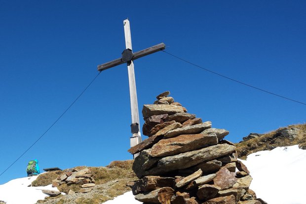
The starting point for this really nice and peaceful hike to the Toblacher Pfannhorn is the pilgrimage town of Kalkstein. Slightly climbing on a gravel trail at first up to the Alfenalm, continuing up to the Ruschletalm (1915 m). Continue on a trouble-free footpath in the head of the valley and across the flower-filled slopes of the Alfneralm. Then in a westerly direction steep up to the Pfanntörl (2508 m). Across the rocky, yet not too difficult north-west ridge, the route proceeds to the big cross on the summit of the Toblacher Pfannhorn, from which you get superb views, among others to the Sexten Dolomites.

Newsletter

Subscribe to our newsletter and receive the best tips every month for current offers, mountain tours, events and much more.