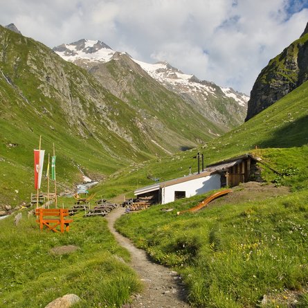
Rote Spitze 2,956 m

The most important at a glance

distance
10.2 km
altitude meters uphill
🔋
1260 m
altitude meters downhill
🔋
1240 m
walking time uphill
3 h
walking time downhill
2:30 h
total walking time
5:30 h
highest point
🞍
2919 m
difficulty
🞽
average
fitness:

* * * * *

🞙🞙🞙🞙🞙

technique:

* * * * *

🞙🞙🞙🞙🞙

public transport:

Mit dem Herz-Ass Wandertaxi bis zur Unterstaller Alm

parking:

Parkplatz Unterstaller Alm - kostenpflichtig

starting point:
Parkplatz Jausenstation Unterstalleralm
destination point:
Rote Spitze
best season:
MAY, JUN, JUL, AUG, SEP

arrival

Parking spot

Car park Unterstalleralm 1.670m

altitude profile

Pdf file

Gpx file

Interactive map

Current weather conditions

Schnee-01-02-03.png

0°C/32°F °C

Description

Get from Unterstalleralm to Oberstalleralm directly via route 16 to the Rote Spitze. From the Alpine inn there is a brief section through the forest initially, which later then rises steeply across Alpine pastures. Upon reaching the ridge, the path branches off to the east and gets to the ridge via boulders. Via this route it is somewhat exposed in a wind gap, however this is secured with wire cables. From there it is an easy climb up to the summit

Newsletter

Subscribe to our newsletter and receive the best tips every month for current offers, mountain tours, events and much more.