Tilliacher Joch No. 100

Beautiful bike tour to the historic border crossing to Italy

The most important at a glance

distance
10.3 km
altitude meters uphill
🔋
750 m
altitude meters downhill
🔋
750 m
highest point
🞍
2090 m
difficulty
🞽
average
circuit
🞍
no
fitness:

* * * * *

🞙🞙🞙🞙🞙

technique:

* * * * *

🞙🞙🞙🞙🞙

parking:

Parkplatz beim Gemeindehaus

starting point:
Obertilliach-Bundesstr. (1440m)
destination point:
Tilliacher Joch (2094m)
best season:
JUN, JUL, AUG, SEP, OCT

arrival

Stop

Obertilliach Gh Weiler

altitude profile

Pdf file

Gpx file

Interactive map

Current weather conditions

Sonne-03.png

-2°C/28°F °C

Description

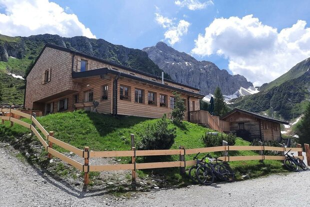
At the bus stop at Hotel Weiler there is a 1 km tarmac country lane down to Mühlboden. From here proceed on a gravel trail, climbing slightly through Dorfertal, whereby flat and somewhat steeper passages alternate. In Pfaffenboden we head to the fork in the right and bear right, continuing across the bridge and arrive at Lake Klapfsee. From here the route continues in a few switchbacks up to Porzehütte (1942 m), just before this, in steeper serpentine bends up to Tilliacher Joch.


Newsletter

Subscribe to our newsletter and receive the best tips every month for current offers, mountain tours, events and much more.