Steinermandl via Rotmannalm

The most important at a glance

distance
5.5 km
altitude meters uphill
🔋
400 m
altitude meters downhill
🔋
340 m
walking time uphill
1 h
walking time downhill
1 h
total walking time
2 h
highest point
🞍
2220 m
difficulty
🞽
easy
fitness:

* * * * *

🞙🞙🞙🞙🞙

public transport:

Mit dem Bus bis zur Bushaltestelle "Gaimberg Zettersfeldbahn" und dann mit der Gondel hinauf fahren.

parking:

Parkplatz Talstation Zettersfeldbahn

starting point:
trail station, Bergstation der Einseilumlaufbahn Zettersfeld
destination point:
hut, Rotmannalm
best season:
MAY, JUN, JUL, AUG, SEP

arrival

Parkplatz

Car park Rottmannalm

altitude profile

Pdf file

Gpx file

Interactive map

Current weather conditions

Sonne-01.png

-6°C/21°F °C

Description

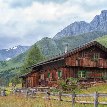
Where Helenental Alpine Road comes to its peak near Zettersfeld (20 minutes northwest of the ropeway’s upper terminal), a path leads across mountain pastures to Rotmannalm, 5 minutes. On the western edge of Zettersfeld, a highly frequented path leads upwards. Where wind railings hold back the snow on a stage of slope in winter, we are already close to artificial Lake Lackenbodensee on 2080 metres above sea level, 40 minutes. The lake reflects the Schleinitz in summer and feeds the snow making machines in winter. It just takes a last little ascent to visit the Steinermandl in the northeast and north of Schoberköpfl (tow lift).

Newsletter

Subscribe to our newsletter and receive the best tips every month for current offers, mountain tours, events and much more.