Ranach circular route

The most important at a glance

distance
7 km
altitude meters uphill
🔋
260 m
altitude meters downhill
🔋
260 m
total walking time
2:20 h
difficulty
🞽
easy
public transport:

Matrei i.O. Korberplatz

parking:

Parking spot Korberplatz

starting point:
Rauterplatz
destination point:
Rauterplatz
best season:
MAR, APR, MAY, JUN, JUL, AUG, SEP, OCT, NOV
route typ:
circuit family tour

arrival

Stop

Matrei i. O. Korberplatz

Parking spot

Car park Korberplatz

altitude profile

Pdf file

Gpx file

Interactive map

Current weather conditions

Sonne-03.png

-2°C/28°F °C

Description

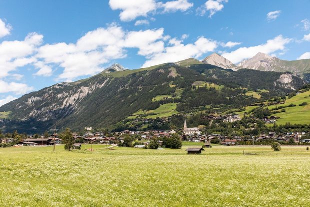
The starting point for this hike is the centre of Matrei in Osttirol. Next to the parish church, a road on the northern side leads up the "Klaunzerberg" in 4 hairpin bends. From here, the path becomes flatter and you can enjoy the panorama of the Tauern community and the view of the mighty ice giants of the Malhamkees in the Virgental valley. The road leads to the "Ranach" district on almost one level (up to this point the hike is also possible with a pushchair), before it leads back down to the bottom of the valley on a path. Here you follow the Hildenweg back to the centre.

Newsletter

Subscribe to our newsletter and receive the best tips every month for current offers, mountain tours, events and much more.