Spitzköfele 2314 m

The most important at a glance

distance
7.8 km
altitude meters uphill
🔋
800 m
altitude meters downhill
🔋
800 m
walking time uphill
2:30 h
walking time downhill
2 h
total walking time
4:30 h
highest point
🞍
2314 m
difficulty
🞽
average
fitness:

* * * * *

🞙🞙🞙🞙🞙

technique:

* * * * *

🞙🞙🞙🞙🞙

parking:

Parkplatz Dorfertal

starting point:
Pfaffenboden
destination point:
Spitzköfele
best season:
JUN, JUL, AUG, SEP

altitude profile

Pdf file

Gpx file

Interactive map

Current weather conditions

Sonne-02.png

-5°C/23°F °C

Description

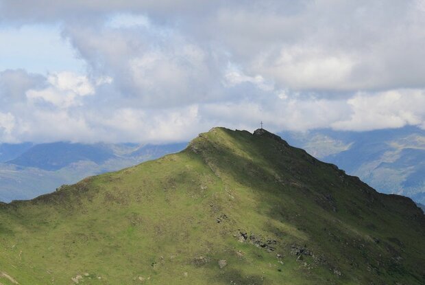
At the junction to Porzehütte cross a little stream to the left and then heading through a shaded forest head up to a shepherd’s lodge. The cattle grazing there has ‘created’ lots of tracks and you have to watch out that you don’t stray from the signposted path. When you are finally on the right path, this proceeds relatively steeply on to the apex of the mountain ridge. From there it is just a few more minutes’ walk to the summit of the Spitzköfele.

Newsletter

Subscribe to our newsletter and receive the best tips every month for current offers, mountain tours, events and much more.