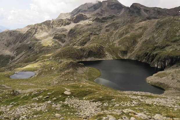
Alkuser See

One of the loveliest mountain lakes in Osttirol. You will come across particularly charming little places on a little hill.

The most important at a glance

distance
20 km
altitude meters uphill
🔋
1705 m
altitude meters downhill
🔋
1703 m
walking time uphill
4:30 h
walking time downhill
3 h
total walking time
7:30 h
highest point
🞍
2430 m
difficulty
🞽
average
fitness:

* * * * *

🞙🞙🞙🞙🞙

technique:

* * * * *

🞙🞙🞙🞙🞙

public transport:

Mit dem Bus bis zur Bushaltestelle "Ainet Abzw. Ort".

parking:

Parkplatz Gemeindeamt Ainet

starting point:
Oberalkus
destination point:
Alkuser See
best season:
MAY, JUN, JUL, AUG, SEP

arrival

Parkplatz

Parkplatz Gemeindehaus Ainet

altitude profile

Pdf file

Gpx file

Interactive map

Current weather conditions

Sonne-02.png

-5°C/23°F °C

Description

From Alkus (Oberalkus 1284m), follow a forest trail up to Potschepol at 2272m. From there, now take the path which proceeds east. After a climb via a trench you come to terrain which features a small pond in front of Alkusersee. Another short climb takes you to the lake. Once you get to Alkuser See you can see the Peace Cross, over from the lake. By then you will really have earned a break and can enjoy the superb panoramic views provided by the Schober group.

Newsletter

Subscribe to our newsletter and receive the best tips every month for current offers, mountain tours, events and much more.